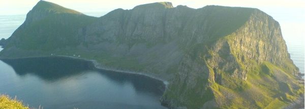
Description island VærøyThe inhabited small island of Værøy is part of (the island group) and is located in the country of , Northern Europe. The distance to the mainland is about 80.3 km. The surface-area of the island is 16.2 km2 and is therefore 0.043 x times greater than the island of Isle of Wight. The island lies in the and the total coastal length is about 45.4 km and the dimensions of the island are approximately 9.4 km by 5.1 km (maximum width). The island is Southwest - Northeast oriented. The coordinates (latitude, longitude) of the island (center) for GPS are 67.67 (67°39'55.9872), 12.65 (12°39'9.5976).The population is 744 and the population density is thus on 40.00 inhabitants per square kilometer (compared Isle of Wight 364 inhabitants / km²). Other places on the island are: Sørland. The island is located in the of the country . It is located in the administrative unit (local administrative level-name ), in the (local administrative level-name ). Direct neighboring islands of Værøy are (distance from central part island to central part of the neighboring islands): 1) Mosken Located 5.1 km EastNorthEast of the island. 2) Moskenesøya Located 15 km EastNorthEast of the island. 3) Røst Located 21.8 km SouthSouthWest of the island. 4) Flakstadøya Located 39.9 km EastNorthEast of the island. 5) Vestvågøya Located 51.8 km NorthEast of the island. 6) Landegode Located 70.5 km NorthNorthWest of the island. 7) Fugløya Located 77.4 km NorthWest of the island. 8) Sandhornøya Located 79.3 km NorthWest of the island. 9) Austvågøy Located 81.7 km NorthEast of the island. 10) Gimsøya Located 87.7 km NorthEast of the island. 11) Meløya Located 93.7 km WestNorthWest of the island. 12) Engeløya Located 97.3 km NorthNorthEast of the island. 13) Åmnøya Located 99 km WestNorthWest of the island. 14) Lundøya Located 107.7 km NorthNorthEast of the island. 15) Nesøya Located 114.1 km West of the island. 16) Hinnøya Located 116.6 km NorthEast of the island. 17) Hadseløya Located 121.8 km NorthEast of the island. 18) Langøya Located 123.8 km NorthEast of the island. 19) Husøya Located 127.2 km West of the island. 20) Lurøya Located 131.5 km West of the island. 21) Tomma Located 148.3 km West of the island. 22) Dønna Located 156.4 km West of the island. 23) Tjeldøya Located 160.9 km NorthNorthEast of the island. 24) Løkta Located 161.1 km West of the island. 25) Andøya Located 173.6 km NorthEast of the island. The source material on the island consists of rocky surface. The land use on the island of Værøy consists of nature 13.7 km2 (85%), and agriculture 0.8 km2 (5%), To return to the overview page of this island click on the following link: Overview island Værøy |
|


