Description island VigurThe inhabited very small island of Vigur is part of (the island group) and is located in the country of , Northern Europe. The distance to the mainland is about 1200 km. The surface-area of the island is 0.410 km2 and is therefore 0.001 x times greater than the island of Isle of Wight. The island lies in the and the total coastal length is about 3.8 km and the dimensions of the island are approximately 1.8 km by 0.38 km (maximum width). The island is North - South oriented. The highest point is 120 meter and is named . The coordinates (latitude, longitude) of the island (center) for GPS are 66.06 (66°3'18.8388), -22.83 (-22°4'58.6524).The population is 5 and the population density is thus on 30.00 inhabitants per square kilometer (compared Isle of Wight 364 inhabitants / km²). The capital of the island is Vigur (located in the South of the island). Other places on the island are: Vigur (Z). The island is located in the of the country . It is located in the administrative unit (local administrative level-name ), in the (local administrative level-name ). Direct neighboring islands of Vigur are (distance from central part island to central part of the neighboring islands): 1) Iceland Located 2 km SouthWest of the island. 2) Æðey Located 8.2 km NorthNorthEast of the island. 3) Skáley Located 67.3 km West of the island. 4) Flatey Located 74.6 km West of the island. 5) Brokey Located 108.4 km West of the island. 6) Drangey Located 142.6 km North of the island. 7) Málmey Located 148.4 km North of the island. 8) Hjörsey Located 170 km West of the island. 9) Hrísey Located 199.7 km North of the island. 10) Viðey Located 213.4 km WestNorthWest of the island. 11) Grímsey Located 222.1 km NorthNorthEast of the island. 12) Flatey Located 223.7 km North of the island. 13) Heimaey Located 313.6 km WestNorthWest of the island. 14) Bjarnarey Located 315.4 km WestNorthWest of the island. 15) Surtsey Located 322.9 km WestNorthWest of the island. 16) Bjarnarey Located 388.6 km North of the island. 17) Papey Located 433.6 km NorthNorthWest of the island. 18) Jan Mayen Located 772.9 km NorthEast of the island. 19) Mykines Located 857.5 km NorthNorthWest of the island. 20) Streymoy Located 862.7 km NorthNorthWest of the island. 21) Vágar Located 863.1 km NorthNorthWest of the island. 22) Eysturoy Located 866.4 km NorthNorthWest of the island. 23) Kalsoy Located 875.5 km NorthNorthWest of the island. 24) Kunoy Located 880.6 km NorthNorthWest of the island. 25) Viðoy Located 883.9 km NorthNorthWest of the island. There are also (seasonal) ferry connections for pedestrians (-cyclists) with other (neighboring) island(s). The source material on the island consists of rocky surface. The land use on the island of Vigur consists of nature 0.4 km2 (95%), To return to the overview page of this island click on the following link: Overview island Vigur |
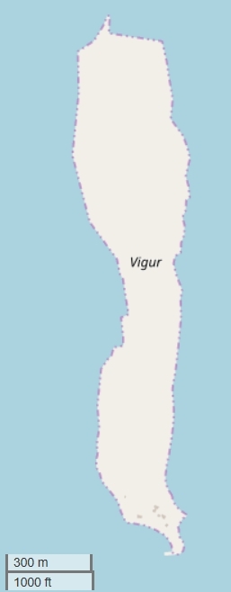
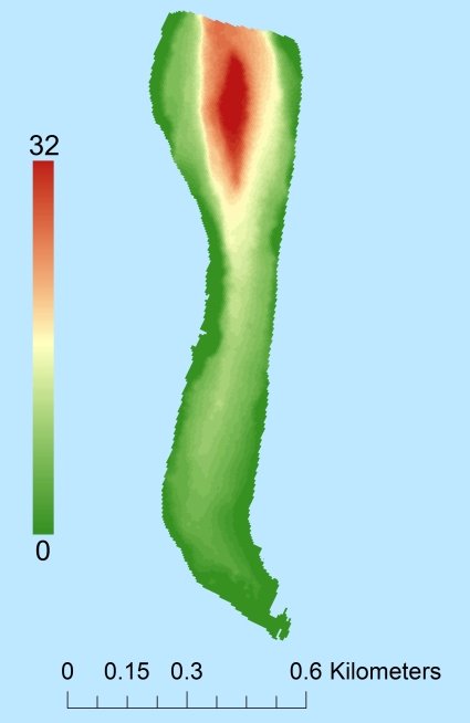
Topographic islandmap Vigur © OpenStreetMap-auteurs, CC-BY-SA. Map Vigur Vigur views: 276 Height map of Vigur |


