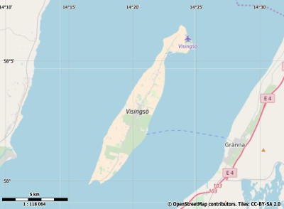
Description island VisingsöThe inhabited small island of Visingsö is part of (the island group) and is located in the country of , Northern Europe. The island is situated in a lake. The distance to the mainland is about 5 km. The surface-area of the island is 24.6 km2 and is therefore 0.065 x times greater than the island of Isle of Wight. The island lies in the and the total coastal length is about 32 km and the dimensions of the island are approximately 14.2 km by 2.7 km (maximum width). The island is South-southwest - North-northeast oriented. The coordinates (latitude, longitude) of the island (center) for GPS are 58.05 (58°0'17.4204), 14.34 (14°2'2.4504).The population is 800 and the population density is thus on 32.00 inhabitants per square kilometer (compared Isle of Wight 364 inhabitants / km²). The capital of the island is Tunnerstad (located in the Center of the island). Other places on the island are: Tunnerstad, Kumlaby, Stigby. The island is located in the of the country . It is located in the administrative unit (local administrative level-name ), in the (local administrative level-name ). Direct neighboring islands of Visingsö are (distance from central part island to central part of the neighboring islands): 1) Torsö Located 79.9 km EastSouthEast of the island. 2) Kållandsö Located 90.2 km SouthEast of the island. 3) Bolmsö Located 112.4 km WestSouthWest of the island. 4) Orust Located 144.3 km South of the island. 5) Tjörn Located 147.7 km South of the island. 6) Koön Located 156.6 km South of the island. 7) Marstrandsön Located 159.9 km South of the island. 8) Öland Located 176 km NorthNorthWest of the island. 9) Læsø Located 198.4 km SouthSouthWest of the island. 10) Hallands Väderö Located 200.6 km WestSouthWest of the island. 11) Ivö Located 206.5 km West of the island. 12) Syd-Koster Located 210.7 km SouthSouthEast of the island. 13) Anholt Located 210.8 km SouthWest of the island. 14) Nord-Koster Located 214.1 km SouthSouthEast of the island. 15) Vendsyssel-Thy Located 217.1 km South of the island. 16) Kirkøy Located 218.9 km SouthSouthEast of the island. 17) Aspö Located 221.2 km WestNorthWest of the island. 18) Hanö Located 222.9 km West of the island. 19) Sturkö Located 224.4 km WestNorthWest of the island. 20) Gotland Located 228 km NorthNorthWest of the island. 21) Utlängan Located 236.9 km WestNorthWest of the island. 22) Utö Located 237.9 km NorthNorthEast of the island. 23) Seeland Located 238 km WestSouthWest of the island. 24) Ven Located 250.4 km WestSouthWest of the island. 25) Ornö Located 250.9 km NorthNorthEast of the island. The source material on the island consists of rocky surface. The land use on the island of Visingsö consists of wood 5.1 km2 (21%), nature 0.3 km2 (1%), and agriculture 18.3 km2 (75%), To return to the overview page of this island click on the following link: Overview island Visingsö |
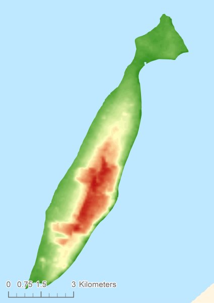
Topographic islandmap Visingsö © OpenStreetMap-auteurs, CC-BY-SA. Map Visingsö Visingsö views: 252 Height map of Visingsö |


