Description island YellThe inhabited small island of Yell is part of (the island group) and is located in the country of , Western Europe. The distance to the mainland is about 234 km. The surface-area of the island is 212.5 km2 and is therefore 0.56 x times greater than the island of Isle of Wight. The island lies in the and the total coastal length is about 157.1 km and the dimensions of the island are approximately 27 km by 11 km (maximum width). The island is North - South oriented. The coordinates (latitude, longitude) of the island (center) for GPS are 60.6 (60°36'9.1944), -1.1 (-1°5'44.1348).The population is 966 and the population density is thus on 4.50 inhabitants per square kilometer (compared Isle of Wight 364 inhabitants / km²). The capital of the island is Mid Yell (located in the East of the island). Other places on the island are: West Sandwick, Burravoe, Mid Yell, Cullivoe, Gloup, Ulsta, Gutcher, Aywick, West Yell, Sellafirth, Copister, Camb, Otterswick. The island is located in the of the country . It is located in the administrative unit (local administrative level-name ), in the (local administrative level-name ). Direct neighboring islands of Yell are (distance from central part island to central part of the neighboring islands): 1) Unst Located 0.8 km North of the island. 2) Fetlar Located 2.5 km NorthNorthWest of the island. 3) Mainland Shetland Located 2.6 km SouthSouthWest of the island. 4) Whalsay Located 12.6 km WestNorthWest of the island. 5) Housay - Out Skerries Located 15.8 km NorthNorthWest of the island. 6) Bruray - Out Skerries Located 16.9 km NorthNorthWest of the island. 7) Muckle Roe Located 17.6 km SouthWest of the island. 8) Papa Stour Located 32.5 km SouthSouthWest of the island. 9) Bressay Located 32.7 km West of the island. 10) Vaila Located 38.8 km SouthWest of the island. 11) Trondra Located 39.8 km West of the island. 12) West Burra Located 41.7 km WestSouthWest of the island. 13) East Burra Located 43.9 km West of the island. 14) Foula Located 61.7 km SouthWest of the island. 15) Fair Isle Located 106.7 km WestSouthWest of the island. 16) North Ronaldsay Located 139.6 km WestSouthWest of the island. 17) Sanday Located 148.5 km WestSouthWest of the island. 18) Papa Westray Located 155.9 km SouthWest of the island. 19) Westray Located 160.7 km SouthWest of the island. 20) Eday Located 164.1 km WestSouthWest of the island. 21) Stronsay Located 169 km WestSouthWest of the island. 22) Rousay Located 176.6 km SouthWest of the island. 23) Egilsay Located 177 km SouthWest of the island. 24) Auskerry Located 179.7 km WestSouthWest of the island. 25) Shapinsay Located 181 km WestSouthWest of the island. The source material on the island consists of Metamorphic rock. The land use on the island of Yell consists of nature 37.1 km2 (18%), wet nature 150.9 km2 (71%), and agriculture 17.2 km2 (8%), To return to the overview page of this island click on the following link: Overview island Yell |
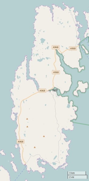
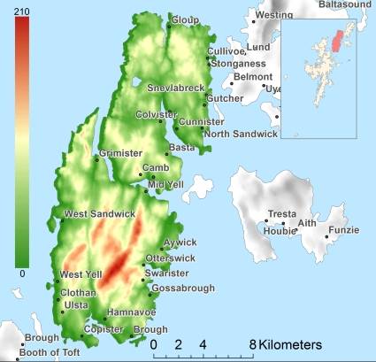
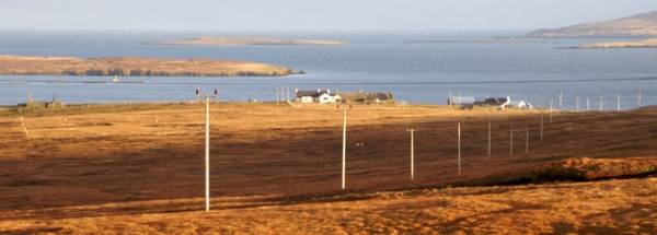
Topographic islandmap Yell © OpenStreetMap-auteurs, CC-BY-SA. Map Yell Yell views: 260 Height map of Yell |


