Youtube Brac Video - Movie
For a detailed description of this island, see our info-island-page:Brac
|
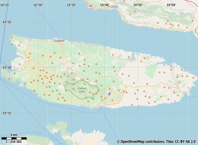
Physical characteristics - Location| Coordinates: | long: 16.64302 lat : 43.31975 | | Coordinates (gr,min,sec): WGS84 | long: 16°38'34.8612 lat : 43°19'1.1082 | | Surface area: | 396 km2 (1.043 x Isle of Wight) | | Length coastline: | 138.7 km | | Average height: | 264 metre | | Length island: | 39.6 km | | Maximum width island (estimate): | 13.4 km | | Name : | not known/no name (0 metre) | | Orientation island: | North - South |
Demographic data island| Habited: | Yes | | Number of inhabitants: | 0 | | Population density: | 0.00 inh/km2 | | Important places (direction): | Sutivan |
|
Naming - Location| Local native name: | Brac | | Archipelago (island group): | | Neighboring islands
(Island hopping): | 1) Šolta 0.752 km West
2) Hvar 3.5 km South
3) Ciovo 11.1 km NorthNorthWest
4) Sveti Klement 14.8 km SouthSouthWest
5) Drvenik Veli 21.3 km WestNorthWest
6) Drvenik Mali 27.6 km WestNorthWest
7) Korcula 29.3 km
8) Proizd 29.5 km South
9) Vis 29.8 km SouthSouthWest
10) Biševo 48.4 km SouthWest
11) Lastovo 54 km South
12) Zlarin 54.3 km NorthWest
13) Prvic 62.4 km NorthWest
14) Žirje 62.5 km WestNorthWest
15) Kaprije 65 km WestNorthWest
16) Mljet 65.4 km SouthEast
17) Murter 74.3 km NorthWest
18) Kornat 87.2 km WestNorthWest
19) Vrgada 89.5 km NorthWest
20) Pašman 96.3 km NorthWest
21) Šipan 97 km SouthEast
22) Palagruža 99.8 km SouthSouthWest
23) Lopud 107.6 km SouthEast
24) Dugi Otok 112.3 km WestNorthWest
25) Kolocep 112.5 km SouthEast
| | Country: | | | Location in Country: | | | Name : | | | Name : | | Places portal2europe
(sister website): | Milna (West)
Sutivan (WestNorthWest)
| | Sea: | | | Distance to main land: | 5.2 km | | Nearest Country: | | | Type Rock outcrop: | rocky surface | | island-Type: | island in sea | | Remarks: | |
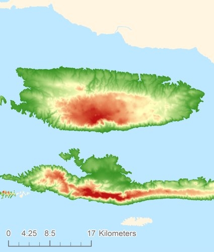
Relief: Height Classes in percentages
Relief: Slope Classes in percentages
|
Weather at Brac
| The weather type in Postira | clear sky |  | | Current temperature: | 19 degrees Celcius
| | Precipitation last 3 hours: | No precipitation | | Wind: | 2.49 meter per second (Wind force - bft 2)
| | Winddirection: | Northeast | | Atmospheric pressure: | 1014 mb
| | Humidity: | 52 %
| | Daylength at 27 July 2024: | 14 hour and 43 minutes | | Sunrise: | 05:38 Europe/Amsterdam | | Sunset: | 20:21 Europe/Amsterdam |
Weather-page: Brac
The weather for the next few hours
Postira - HR (longitude: 16.643, latitude: 43.3198)
Distance weather station to the center island (direction ZZO): 6.32 km
8:00
25 degrees Celcius
1015 mbar
clear sky | 11:00
29 degrees Celcius
1016 mbar
clear sky | 14:00
28 degrees Celcius
1015 mbar
clear sky | 17:00
24 degrees Celcius
1015 mbar
clear sky | 20:00
23 degrees Celcius
1016 mbar
clear sky |
Climate: Temperature and Precipitation
Transport on your island-holiday| Directly accessible from Western Europe (The Netherlands) by plane: | No | | International airport present : | No | | Accessible by car: | No | | Distance from Western Europe (The Netherlands) (rough estimate): | 0 km | | Ferry connection - Car - Car - with mainland: | No | | Boat Connection - pedestrian - with mainland: | No | | Ferry - Car - connect with another island - Island hopping: | No | | Boat Connection - pedestrian - with another island: | No | | Bicycle facilities: | No |
island-Sights, island-Tourism - island-attractions
island accommodation: Hotel ,Holiday Home, Camping  Hotel Hotel |
Hotel at Brac booking.com
|
 Camping Camping | Not known
| | Holiday Home | | | Bed & Breakfast | | | accommodation-page | Brac
|
Social media - Multimedia
 Videos youtube Brac Videos youtube Brac
 Photos (Flickr) of the place Brac Photos (Flickr) of the place Brac
Bings maps Brac
Mapquest Brac
Loc.Alize.us Brac
Landuse Brac
| Forest |
91.8 km2 |
|
| Nature |
183.3 km2 |
|
| Agriculture |
89.4 km2 |
|
| Wet nature |
0 km2 |
|
| Water |
5.3 km2 |
|
| Urban area |
11.6 km2 |
|
| Infrastructure |
0.6 km2 |
|
| Viticulture |
13.7 km2 |
|
| Rock outcrop |
0.4 km2 |
|
|
|
|
|


 Videos youtube Brac
 Photos (Flickr) of the place Brac


 Wikipedia:
  UNESCO:
  Camping