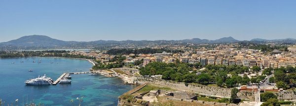
Youtube Corfu Video - Movie
For a detailed description of this island, see our info-island-page:Corfu
|
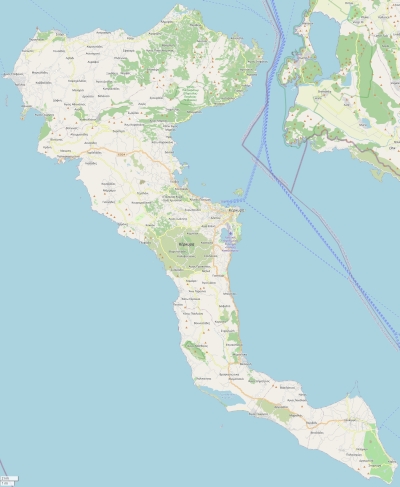
Physical characteristics - Location| Coordinates: | long: 19.84630 lat : 39.63442 | | Coordinates (gr,min,sec): WGS84 | long: 19°50'46.6728 lat : 39°38'3.9264 | | Surface area: | 595.5 km2 (1.568 x Isle of Wight) | | Length coastline: | 211.8 km | | Average height: | 138 metre | | Length island: | 64 km | | Maximum width island (estimate): | 32 km | | Name : | Pantokrator (906 metre) | | Orientation island: | Northwest - Southeast |
Demographic data island| Habited: | Yes | | Number of inhabitants: | 109537 | | Population density: | 179.00 inh/km2 | | Important places (direction): | Sidari (N), Rodha (N), Palaiokastritsa (NW), Korfoe (O), Agios Gordios (W), Moraitika (Z), Kavos (Z) |
|
Naming - Location
Relief: Height Classes in percentages
Relief: Slope Classes in percentages
|
Weather at Corfu
| The weather type in Corfu | scattered clouds |  | | Current temperature: | 17 degrees Celcius
| | Precipitation last 3 hours: | No precipitation | | Wind: | 4.63 meter per second (Wind force - bft 3)
| | Winddirection: | West-northwest | | Atmospheric pressure: | 1008 mb
| | Humidity: | 66 %
| | Daylength at 21 November 2024: | 9 hour and 49 minutes | | Sunrise: | 06:32 Europe/Amsterdam | | Sunset: | 16:21 Europe/Amsterdam |
Weather-page: Corfu
The weather for the next few hours
Kontokali - GR (longitude: 19.8463, latitude: 39.6344)
Distance weather station to the center island (direction ZZW): 1.27 km
13:00
16 degrees Celcius
1009 mbar
broken clouds | 16:00
16 degrees Celcius
1011 mbar
broken clouds | 19:00
15 degrees Celcius
1013 mbar
overcast clouds | 22:00
16 degrees Celcius
1012 mbar
broken clouds | 1:00
16 degrees Celcius
1011 mbar
light rain |
Climate: Temperature and Precipitation
Transport on your island-holiday| Directly accessible from Western Europe (The Netherlands) by plane: | Yes | | International airport present : | Yes | | Accessible by car: | Yes | | Distance from Western Europe (The Netherlands) (rough estimate): | 2326 km | | Ferry connection - Car - Car - with mainland: | Yes | | Boat Connection - pedestrian - with mainland: | Yes | | Ferry - Car - connect with another island - Island hopping: | Yes | | Boat Connection - pedestrian - with another island: | Yes | | Bicycle facilities: | Yes |
island-Island, island-Tourism - island-attractions
island accommodation: Hotel ,Holiday Home, Camping  Hotel Hotel |
Hotel at Korfoe booking.com
|
 Camping Camping | 1) Camping Paleokastritsa
2) Dionysus
3) Ipsos Beach Camping Corfu
4) Karda Beach
5) Roda Beach Camping
| | Holiday Home | | | Bed & Breakfast | | | accommodation-page | Corfu
|
Social media - Multimedia
 Videos youtube Corfu Videos youtube Corfu
 Photos (Flickr) of the place Corfu Photos (Flickr) of the place Corfu
Bings maps Corfu
Mapquest Corfu
Loc.Alize.us Corfu
|
 Videos youtube Corfu
 Photos (Flickr) of the place Corfu


 Wikipedia:
  UNESCO:
  Camping