Youtube Kythira Video - Movie
VIDEO
Kythira
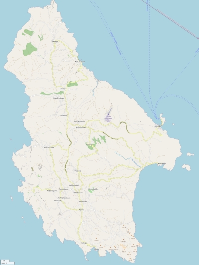
Physical characteristics - Location Coordinates: long: 22.98287 lat : 36.24816 Coordinates (gr,min,sec): WGS84 long: 22°58'58.3248 lat : 36°14'53.3868 Surface area: 276.6 km2 (0.728 x Isle of Wight) Length coastline: 111.2 km Average height: 221 metre Length island: 30 km Maximum width island (estimate): 17.5 km Name : Mermigkari (525 metre) Orientation island: North-northwest - South-southeast
Demographic data island Habited: Yes Number of inhabitants: 3398 Population density: 299.40 inh/km2 Important places (direction): Áno Livádi, Potamós, Agía Pelagía.Kálamos, Livádi
Naming - Location Local native name: Κύθηρα Archipelago (island group): Ionian Islands Neighboring islands 1) Monemvasia 34.1 km NorthNorthEast Crete 74.8 km SouthEast Ydra 107.6 km NorthNorthEast Milos 118.1 km EastNorthEast Poros 131.2 km NorthNorthEast Kimolos 141 km EastNorthEast Aigina 150.5 km NorthNorthEast Serifos 152.1 km NorthEast Sifnos 160.4 km EastNorthEast Kythnos 161.9 km NorthEast Folegandros 162.2 km EastNorthEast Gavdos 167.4 km SouthEast Salamina 170.9 km NorthNorthEast Kea 172.6 km NorthEast Sikinos 180.8 km EastNorthEast Antiparos 189.8 km EastNorthEast Paros 198.1 km EastNorthEast Ios 199.3 km EastNorthEast Syros 200.8 km NorthEast Santorini 202.5 km East Euboea 215.8 km NorthEast Naxos 219.6 km EastNorthEast Zakynthos 225.8 km NorthWest Andros 227.2 km NorthEast Tinos 228.4 km NorthEast Country: Greece Location in Country: South Name Periféreia - περιοχή
: Region Attica Name Nomos - Πειραιάς: Regional unit Piraeus Main place: Kýthira Places portal2europe Kithira (South)Potamos (NorthWest)Location Main place: South Sea: Aegean Sea Distance to main land: 14 km Nearest Country: Greece island-Type: island in sea
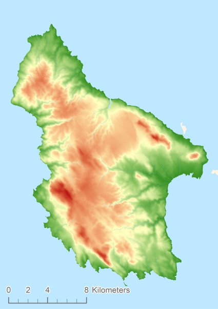
Relief: Height Classes in percentages
Relief: Slope Classes in percentages
Weather at Kythira
The weather type in Mitata light rain Current temperature: 19 degrees Celcius
Precipitation last 3 hours: No precipitation Wind: 8.75 meter per second (Wind force - bft 5)
Winddirection: West Atmospheric pressure: 1010 mb
Humidity: 88 %
Daylength at 21 November 2024: 10 hour and 5 minutes Sunrise: 06:11 Europe/Amsterdam Sunset: 16:16 Europe/Amsterdam
Weather-page: Kythira
The weather for the next few hours
Mitata - GR (longitude: 22.9829, latitude: 36.2482)10:00 13:00 16:00 19:00 22:00
Climate: Temperature and Precipitation
Transport on your island-holiday Directly accessible from Western Europe (The Netherlands) by plane: Yes International airport present : Yes Accessible by car: Yes Distance from Western Europe (The Netherlands) (rough estimate): 2925 km Ferry connection - Car - Car - with mainland: Yes Boat Connection - pedestrian - with mainland: Yes Ferry - Car - connect with another island - Island hopping: Yes Boat Connection - pedestrian - with another island: Yes Bicycle facilities: Yes
island-Island, island-Tourism - island-attractions island accommodation: Hotel ,Holiday Home, Camping
Hotel at Kythira booking.com Not known Holiday Home Bed & Breakfast accommodation-page Kythira
Social media - Multimedia
Bings maps Kythira
Mapquest Kythira
Loc.Alize.us Kythira


 Videos youtube Kythira
 Photos (Flickr) of the place Kythira


 Wikipedia:
  Camping