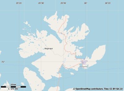
|
|
|
Youtube Magerøya Video - Movie
For a detailed description of this island, see our info-island-page:Magerøya
|
Physical characteristics - Location| Coordinates: | long: 25.47255 lat : 71.05618 | | Coordinates (gr,min,sec): WGS84 | long: 25°2'5.0118 lat : 71°3'22.2444 | | Surface area: | 421.4 km2 (1.11 x Isle of Wight) | | Length coastline: | 503.2 km | | Average height: | 190 metre | | Length island: | 30.8 km | | Maximum width island (estimate): | 27.8 km | | Name : | Gråkallfjellet (0 metre) | | Orientation: | No maindirection-circular |
Demographic data island| Habited: | Yes | | Number of inhabitants: | 3201 | | Population density: | 7.20 inh/km2 | | Important places (direction): | Kamøyvær, Skarsvåg, Nordvågen, Gjesvær |
|
Naming - Location| Local native name: | Magerøya | | Archipelago (island group): | | Neighboring islands
(Island hopping): | 1) Måsøya 6.9 km WestSouthWest
2) Hjelmsøya 14.9 km West
3) Havøya 19.9 km West
4) Rolvsøya 38 km WestSouthWest
5) Reinøya 38.1 km WestSouthWest
6) Ingøya 39.9 km West
7) Kvaløya 58.4 km SouthWest
8) Sørøya 69 km WestSouthWest
9) Reinøya 71.2 km South
10) Seiland 76.6 km SouthWest
11) Stjernøya 115 km SouthWest
12) Silda 148 km WestSouthWest
13) Arnøya 188.4 km WestSouthWest
14) Uløya 209.6 km SouthWest
15) Vanna 216.5 km WestSouthWest
16) Reinøya 231.9 km WestSouthWest
17) Helgøya 233.9 km WestSouthWest
18) Ringvassøya 237.4 km WestSouthWest
19) Rebbenesøya 255.9 km WestSouthWest
20) Kvaløya 270.1 km WestSouthWest
21) Senja 320.5 km WestSouthWest
22) Dyrøya 362.6 km WestSouthWest
23) Andørja 381.5 km SouthWest
24) Andøya 393.3 km WestSouthWest
25) Rolla 395.8 km SouthWest
| | Country: | | | Location in Country: | | | Name : | | | Name : | | | Main place: | Honningsvåg | Places portal2europe
(sister website): | Honningsvaag (Central)
Nordvaagen (Central)
| | Location Main place: | East-southeast | | Sea: | | | Distance to main land: | 1.2 km | | Nearest Country: | | | Type Rock outcrop: | rocky surface | | island-Type: | island in sea | | Remarks: | |
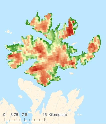
Relief: Height Classes in percentages
Relief: Slope Classes in percentages
|
Weather at Magerøya
| The weather type in Nordmannset | light snow |  | | Current temperature: | -3 degrees Celcius
| | Precipitation last 3 hours: | No precipitation | | Wind: | 3.6 meter per second (Wind force - bft 3)
| | Winddirection: | Southeast | | Atmospheric pressure: | 1013 mb
| | Humidity: | 69 %
| | Daylength at 21 November 2024: | 0 hour and 0 minutes | | Sunrise: | 01:00 Europe/Amsterdam | | Sunset: | 01:00 Europe/Amsterdam |
Weather-page: Magerøya
The weather for the next few hours
Nordmannset - NO (longitude: 25.4725, latitude: 71.0562)
Distance weather station to the center island (direction N): 54.06 km
13:00
-1 degrees Celcius
1010 mbar
light snow | 16:00
0 degrees Celcius
1007 mbar
light snow | 19:00
0 degrees Celcius
1004 mbar
light snow | 22:00
-0 degrees Celcius
1001 mbar
light snow | 1:00
-1 degrees Celcius
998 mbar
light snow |
Climate: Temperature and Precipitation
Transport on your island-holiday| Directly accessible from Western Europe (The Netherlands) by plane: | No | | International airport present : | No | | Accessible by car: | No | | Distance from Western Europe (The Netherlands) (rough estimate): | 0 km | | Ferry connection - Car - Car - with mainland: | No | | Boat Connection - pedestrian - with mainland: | No | | Ferry - Car - connect with another island - Island hopping: | No | | Boat Connection - pedestrian - with another island: | No | | Bicycle facilities: | No |
island-Island, island-Tourism - island-attractions
island accommodation: Hotel ,Holiday Home, Camping  Hotel Hotel |
Hotel at Magerøya booking.com
|
 Camping Camping | 1) Kirkeporten Camping
2) NAF Nordkapp Camping
| | Holiday Home | | | Bed & Breakfast | | | accommodation-page | Magerøya
|
Social media - Multimedia
 Videos youtube Magerøya Videos youtube Magerøya
 Photos (Flickr) of the place Magerøya Photos (Flickr) of the place Magerøya
Bings maps Magerøya
Mapquest Magerøya
Loc.Alize.us Magerøya
Landuse Magerøya
| Forest |
0 km2 |
|
| Nature |
324 km2 |
|
| Agriculture |
0 km2 |
|
| Wet nature |
2.5 km2 |
|
| Water |
1.4 km2 |
|
| Urban area |
1.3 km2 |
|
| Infrastructure |
0.3 km2 |
|
| Viticulture |
0 km2 |
|
| Rock outcrop |
91.9 km2 |
|
|
|
|
|
|
|


 Videos youtube Magerøya
 Photos (Flickr) of the place Magerøya


 Wikipedia:
  UNESCO:
  Camping