|
|
|
Youtube Streymoy Video - Movie
For a detailed description of this island, see our info-island-page:Streymoy
|
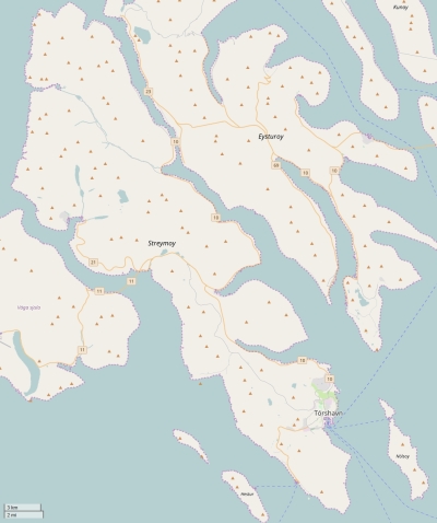
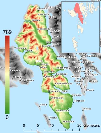
Physical characteristics - Location| Coordinates: | long: -7.00366 lat : 62.12702 | | Coordinates (gr,min,sec): WGS84 | long: -7°0'13.1868 lat : 62°7'37.2576 | | Surface area: | 377.6 km2 (0.994 x Isle of Wight) | | Length coastline: | 161.9 km | | Average height: | 337 metre | | Length island: | 47 km | | Maximum width island (estimate): | 12 km | | Name : | Kopsenni: noordwesten van het eiland. (789 metre) | | Orientation island: | North-northwest - South-southeast |
Demographic data island| Habited: | Yes | | Number of inhabitants: | 23420 | | Population density: | 57.40 inh/km2 | | Important places (direction): | Kollafjørður, Hoyvík, Argir, Vestmanna |
|
Naming - Location
Relief: Height Classes in percentages
Relief: Slope Classes in percentages
|
Weather at Streymoy
| The weather type in Streymoy region | light snow |  | | Current temperature: | 1 degrees Celcius
| | Precipitation last 3 hours: | No precipitation | | Wind: | 5.14 meter per second (Wind force - bft 3)
| | Winddirection: | North | | Atmospheric pressure: | 1000 mb
| | Humidity: | 80 %
| | Daylength at 21 November 2024: | 6 hour and 32 minutes | | Sunrise: | 09:58 Europe/Amsterdam | | Sunset: | 16:30 Europe/Amsterdam |
Weather-page: Streymoy
The weather for the next few hours
Streymoy region - FO (longitude: -7.0037, latitude: 62.127)
Distance weather station to the center island (direction N): not known
13:00
1 degrees Celcius
999 mbar
light snow | 16:00
2 degrees Celcius
1000 mbar
light snow | 19:00
2 degrees Celcius
1002 mbar
light snow | 22:00
1 degrees Celcius
1003 mbar
light snow | 1:00
0 degrees Celcius
1004 mbar
overcast clouds |
Climate: Temperature and Precipitation
Transport on your island-holiday| Directly accessible from Western Europe (The Netherlands) by plane: | No | | International airport present : | Yes | | Accessible by car: | Yes | | Distance from Western Europe (The Netherlands) (rough estimate): | 1725 km | | Ferry connection - Car - Car - with mainland: | Yes | | Boat Connection - pedestrian - with mainland: | Yes | | Ferry - Car - connect with another island - Island hopping: | Yes | | Boat Connection - pedestrian - with another island: | Yes | | Bicycle facilities: | Yes |
island-Island, island-Tourism - island-attractions
island accommodation: Hotel ,Holiday Home, Camping  Hotel Hotel |
Hotel at Streymoy booking.com
|
 Camping Camping | 1) Vestmanna Camping
2) Tórshavn Camping
3) Lómundaroyri camping
| | Holiday Home | | | Bed & Breakfast | | | accommodation-page | Streymoy
|
Social media - Multimedia
 Videos youtube Streymoy Videos youtube Streymoy
 Photos (Flickr) of the place Streymoy Photos (Flickr) of the place Streymoy
Bings maps Streymoy
Mapquest Streymoy
Loc.Alize.us Streymoy
|
|
|


 Videos youtube Streymoy
 Photos (Flickr) of the place Streymoy


 Wikipedia:
  Camping